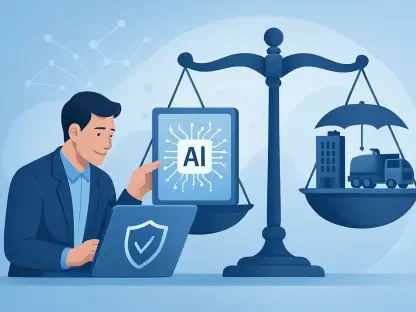

In an era where every sector is advancing with the aid of technology, agriculture is no exception. Satellite data has emerged as a powerful tool, transforming agricultural insurance by enhancing accuracy and speeding up claims processing. This technological advancement is pivotal given agriculture’s vulnerability to environmental hazards and climate anomalies. By integrating satellite monitoring, risk assessment, and loss verification in agricultural insurance are streamlined, contributing significantly to global food security. By tapping into the potential of satellite technology, agricultural insurance processes are not only becoming more efficient but also more transparent and reliable.
Revolutionizing the Claims Process
Challenges of Traditional Agricultural Insurance
Traditional agricultural insurance is laden with challenges that hinder its efficiency, primarily due to the expansive nature of farmlands and the unpredictability of weather patterns. Manual inspections are not only labor-intensive but also time-consuming and often result in inaccuracies. Farmers and insurers have long been troubled by the limitations of conventional insurance frameworks, which rely on physical inspections. This approach is subject to human error and requires extensive paperwork, which only adds layers of complexity and time to the claims process. Moreover, lengthy waiting times and intricate bureaucracy often cause frustration and financial strain on farmers, who may resort to fraudulent claims when assessments are inaccurate.
The Promise of Satellite Monitoring
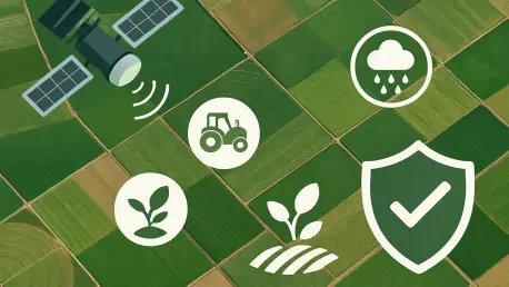
Satellite monitoring presents a groundbreaking solution to these challenges by providing continuous, automated, and near-real-time observation of agricultural lands. Equipped with sophisticated sensors, satellite technology offers reliable and objective assessments, capturing minute changes in vegetation health and environmental conditions. This technological leap eliminates accessibility barriers, making it feasible for farmers in remote or climatically volatile regions to monitor their crops through mobile and web applications. This accessibility significantly revolutionizes the claims process by enabling instantaneous claim initiation, drastically reducing the time required to process claims and thus alleviating financial pressure on farmers.
Modern Trends in Satellite Technology for Insurance
Enhanced Claim Processing Efficiency
The integration of satellite technology has markedly enhanced the efficiency of agricultural insurance claim processing speed, slashing wait times from what used to be weeks down to mere days or even hours. This acceleration in processing time helps reduce financial stress on farmers, allowing them to make timely decisions about replanting, thus encouraging continued productivity. The traditional need for travel and manual inspections is also decreased, cutting down on administrative and operational costs for insurance companies. Furthermore, the utilization of objective satellite imagery acts as a deterrent against fraudulent claims and promotes transparency, thereby fostering greater trust between insurers and farmers.
Improving Transparency and Reducing Fraud
With the implementation of satellite data, transparency within the agricultural insurance framework has reached new heights. This technology curtails the tendency for fraudulent claims, as satellite imagery provides an objective and verifiable record of the insured property. Trust once hindered by ambiguous claim evaluations now benefits from this clear, data-driven transparency. Among insured parties, it boosts confidence in the system, as payments align more accurately with actual damages and conditions. For insurers, the reliance on satellite data reduces the occurrence of disputes, diminishing potential conflict through the unbiased nature of the data presented.
Key Technological Elements in Action
The Role of Advanced Imaging Technologies
At the heart of this technological transformation are advanced imaging technologies, including multispectral and hyperspectral imaging. These technologies enable high-resolution monitoring and provide an intricate view into various aspects of farm environments such as crop health, soil moisture, and weather impacts. Artificial intelligence plays a crucial role by analyzing vast data sets, identifying critical patterns, and detecting anomalies that are indispensable for efficient claim assessments. The precision and detail offered by these imaging technologies ensure that each claim is processed with the utmost accuracy, benefiting both insurers and farmers alike.
Integration with Modern Applications
The integration of satellite data into modern applications is vital for its effective utilization by stakeholders across the agricultural spectrum. APIs and user-friendly application interfaces facilitate comprehensive access to satellite data, enabling automated responses to loss events and allowing seamless initiation of claims. Additionally, blockchain technology is increasingly employed to log claims in a transparent and tamper-proof manner, further enhancing trust and accountability within the system. This integration effectively opens up satellite technology to a broader audience, allowing for its application across various platforms and ensuring that farmers and insurers can leverage this data to its fullest potential.
Benefits and Challenges of Farming with Satellite Data
Stakeholder Advantages
The incorporation of satellite data into agricultural insurance offers considerable advantages to all involved stakeholders. For farmers, the prompt settlement of claims reduces the likelihood of rejection due to inadequate evidence, minimizing disruptions to farming activities. Insurers benefit from the decreased potential for fraud and significantly lowered administrative costs. This fine-tuning of claim assessments builds a stronger brand reputation and positions them as leaders in innovative insurance solutions. Governments gain through reduced risks of subsidy fraud and the expanded reach of policies. Further, data-driven programs foster sustainable agricultural practices, contributing to a holistic approach toward global food security initiatives.
Addressing Ongoing Challenges
Despite the clear benefits, satellite data integration into agricultural insurance is not without its challenges. Although the cost of high-resolution imagery is declining, it still represents a significant investment for many institutions. There is also a critical need for expertise in data interpretation and processing to maximize the insights delivered by satellite technologies. Such expertise ensures that the vast amount of data collected can be effectively translated into actionable information. Furthermore, environmental factors, such as persistent cloud cover, may occasionally hinder data reception, though advancements in technology continue to address and mitigate these challenges.
Navigating Future Pathways
Ensuring Resilience for a Brighter Future
The future of agricultural insurance with satellite data underscores the importance of making resilient and climate-proof solutions accessible worldwide. The advancements seen so far have placed satellite monitoring at the forefront of insurance claim processes, driving resilience and sustainability in the agricultural sector. The adoption and integration of these innovations are not merely expected to continue; they are becoming essential in adapting to the changing climate and agricultural landscape. As these technologies evolve, they promise to sustain productive farming by providing reliable, responsive support systems.
The Road Ahead for Global Agriculture
In today’s rapidly evolving world, technology permeates nearly every industry, and agriculture stands as no exception. The advent of satellite data has become a transformative force within agricultural insurance, significantly enhancing the accuracy and speed of claims processing. This technological leap is especially crucial as agriculture remains highly susceptible to environmental threats and unpredictable climate patterns. The use of satellite technology in this sector is revolutionizing how insurance companies assess risks and verify claims. By integrating satellite monitoring, risk assessment and loss verification in agricultural insurance are greatly streamlined, playing a vital role in fortifying global food security.
It allows for precise monitoring of weather conditions, crop health, and potential environmental hazards without the need for constant physical inspections. This not only accelerates and simplifies the insurance processes but also ensures that they are more transparent and reliable. Farmers benefit from quicker insurance payouts and more dependable policies, which provide a safety net against unforeseen natural events. Ultimately, the adoption of satellite data is not just enhancing efficiency; it’s reshaping the backbone of agricultural insurance, ensuring that it can better support farmers around the world while contributing to sustainability and security in the global food chain.