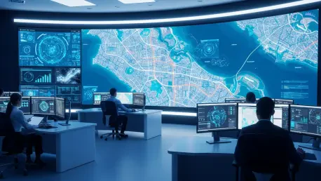

The global insurance landscape is undergoing a radical transformation as the reliance on historical catastrophe models gives way to a demand for immediate, ground-level intelligence during unfolding disasters. This fundamental shift is exemplified by the recent strategic acquisition of McKenzie Intelligence Services by Verisk, a move that integrates high-resolution geospatial data into its established Catastrophe and Risk Solutions unit. By transitioning from static snapshots of risk to a dynamic environment, the company empowers insurers to conduct property-level damage assessments even as an event continues to develop. This capability is no longer a luxury but a necessity in an era where the frequency and severity of climate-related incidents require rapid response times to maintain financial stability and trust. As global markets face increasing volatility, the ability to synthesize vast amounts of satellite and aerial imagery into actionable insights allows carriers to move beyond guesswork and toward a factual, real-time understanding of their exposures and liabilities.
Military-Grade Intelligence and Geospatial Innovation
The integration of military-grade geospatial intelligence represents a significant leap forward in how insurance claims are triaged and how resources are deployed following a catastrophe. By utilizing the advanced technology pioneered by McKenzie Intelligence Services, insurers can now bypass the traditional delays inherent in older modeling techniques, which often relied on post-event site visits or low-resolution imagery. Instead, the new system offers a granular view of specific assets during the height of wildfires or floods, providing a level of clarity that was previously impossible to achieve. Reinsurers, in particular, benefit from this incident-level data, as it allows them to quantify their exact exposure with high confidence while a disaster is still occurring. This precision reduces the operational friction that typically follows a large-scale event, ensuring that aid and financial settlements reach policyholders much faster than in previous years. The technological synergy here effectively turns chaotic data into a structured roadmap for recovery efforts.
Beyond the immediate threats posed by natural disasters, this acquisition significantly enhances the capacity to track and analyze human-led disruptions, such as strikes, riots, and instances of political violence. These specific risks have historically been difficult to price accurately due to their unpredictable nature and the speed at which they can escalate across urban environments. However, the infusion of sophisticated geospatial monitoring allows for the detailed tracking of critical infrastructure and supply chain vulnerabilities during periods of intense civil unrest. This creates a far more comprehensive risk profile for underwriters, accounting for both environmental hazards and the complex geopolitical tensions that characterize the modern world. By monitoring movement patterns and structural impacts in real-time, the platform provides a dual-layer of protection that helps insurers navigate the intricate intersection of social instability and physical damage. This comprehensive approach ensures that global commercial entities remain resilient against a wider spectrum of threats.
The Connected Ecosystem: Building a Synchronized Global Risk Infrastructure
A central component of this acquisition involves the development of a fully connected risk platform designed to eliminate the data silos that have long plagued the insurance and reinsurance sectors. By merging live intelligence from McKenzie Intelligence Services with existing industry tools like the Verisk Model Exchange and Synergy Studio, the organization is effectively building a unified, cloud-native workflow for its clients. This interconnected ecosystem ensures that real-time data points flow directly into the financial and operational systems used by brokers, underwriters, and claims adjusters on a daily basis. The seamless transition of information allows for more frequent and accurate updates to risk models, which can now be adjusted in response to live feedback loops rather than waiting for quarterly reports. Such technical cohesion is essential for modern firms that need to manage large portfolios across multiple jurisdictions, as it provides a single source of truth for risk assessment. This holistic view of the market landscape fosters a more efficient environment for all stakeholders.
The successful incorporation of specialized geospatial tools into the broader global infrastructure established a new benchmark for how the insurance market interpreted and responded to live data. While the initial financial impact was expected to remain neutral, the long-term value derived from a proprietary pipeline of real-time intelligence offered a distinct competitive advantage for early adopters. It became clear that the primary driver of policyholder protection was the ability to act on immediate insights rather than relying on outdated projections. To capitalize on these advancements, firms should prioritize the integration of API-driven data streams into their core underwriting engines to minimize manual intervention during crisis events. Furthermore, stakeholders were encouraged to invest in training their teams to utilize high-resolution imagery for proactive loss mitigation, rather than just reactive claims handling. This strategic shift moved the industry closer to a model of continuous monitoring, where risk management was treated as a perpetual process to ensure long-term stability.