
The New Frontier of Climate Resilience
As climate volatility intensifies, driving a surge in the frequency and severity of natural catastrophes, industries from insurance to banking are grappling with unprecedented levels of risk. The traditional models used to predict and manage these events are proving increasingly inadequate, creating an urgent need for more dynamic, accurate, and timely intelligence. This article explores a pivotal shift in the climate risk landscape, centered on a landmark partnership between ICEYE, a leader in synthetic aperture radar (SAR) satellite technology, and Risk Management Partners, a Munich Re unit specializing in climate risk analysis. This collaboration is not merely an incremental improvement; it signals the dawn of a new era where space-based observation becomes a cornerstone of terrestrial risk management, offering a clearer path toward global economic resilience.
From Reactive Response to Proactive Intelligence
For decades, catastrophe risk management has been a largely reactive discipline. Insurers, corporations, and governments have relied on historical data and probabilistic models to forecast future losses. However, the accelerating pace of climate change is rendering historical patterns less reliable, leaving businesses exposed to unforeseen events. The limitations of this backward-looking approach are most apparent in the immediate aftermath of a disaster, where a lack of real-time, ground-level data hampers response efforts, delays insurance claims, and complicates recovery. This fundamental gap has spurred a technological revolution, pushing the industry toward solutions that can provide a precise, up-to-the-minute understanding of a catastrophe as it unfolds—a shift from reactive damage assessment to proactive, data-driven intelligence.
A Partnership Forged in the Face of Climate Volatility
Bridging the Gap: Integrating Satellite Data with Risk Analytics
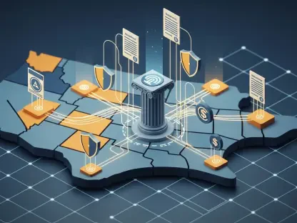
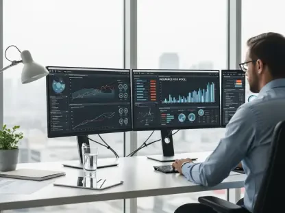
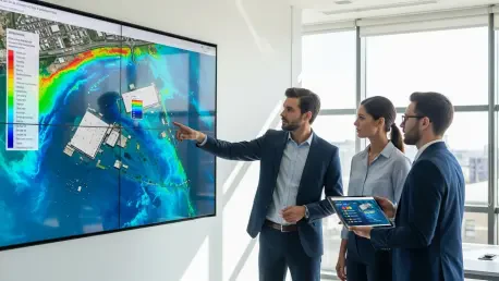
At the heart of this evolution is the integration of ICEYE’s advanced flood data and analytics directly into Munich Re’s Location Risk Intelligence platform. This strategic move provides users in insurance, banking, real estate, and other corporate sectors with an unparalleled ability to monitor and assess flood risk. By leveraging ICEYE’s SAR satellite constellation, which can see through clouds and darkness, the platform delivers near-real-time analysis and reporting before, during, and after a flood event. As the first commercial provider to supply event-level flood data to the platform, ICEYE offers critical metrics like severity forecasts and precise measurements of flood extent and depth, enabling faster, more informed decision-making when it matters most.
Beyond Real-Time: Unlocking Historical and Predictive Insights
The collaboration’s vision extends far beyond immediate disaster response. A planned expansion in January 2026 will integrate ICEYE’s Flood Archive and Flood Early Warning tools, transforming the platform into a comprehensive risk management solution. The Flood Archive will allow users to analyze historical events, providing a rich dataset to refine risk models and better understand long-term vulnerabilities. Simultaneously, the Flood Early Warning system will offer predictive insights, giving businesses crucial lead time to prepare for impending floods. This dual capability—learning from the past while anticipating the future—represents a significant leap forward, empowering organizations to build more robust and forward-looking resilience strategies.
Expanding the Scope: From Floods to Wildfires and Hurricanes
While flooding is the initial focus, the partnership is designed to address the multifaceted nature of climate risk. Munich Re will globally resell other ICEYE peril-focused products, including those for hurricanes and wildfires. This demonstrates the scalability of satellite-based intelligence across a wide spectrum of natural catastrophes. This broad-scope approach is underpinned by ICEYE’s continued investment in its satellite network, which enhances data acquisition capabilities for a growing range of disaster scenarios. The consensus from both partners is clear: combining innovative satellite technology with powerful analytics is the most effective way for businesses to understand and manage their full exposure to an evolving risk landscape.
The Future Trajectory: AI, Automation, and Global Coverage
The fusion of high-resolution satellite imagery with sophisticated analytics platforms is setting a new industry standard. Looking ahead, this trend will be supercharged by advancements in artificial intelligence and machine learning, which will be essential for processing the vast streams of data from satellite constellations. This will enable increasingly automated and granular risk assessments, delivered at unprecedented speeds. As satellite networks like ICEYE’s continue to expand, their global coverage and revisit rates will improve, shrinking the data gap for even the most remote regions. The future of risk management will be defined by this ability to generate near-instant, actionable intelligence for any peril, anywhere on Earth.
Actionable Intelligence: A New Playbook for Risk Managers
The primary takeaway from this partnership is the emergence of a new, proactive playbook for managing climate risk. For insurers, access to real-time flood depth and extent data can radically accelerate claims processing and fraud detection. For banking and real estate, it provides a powerful tool to assess portfolio risk and conduct due diligence on assets in climate-vulnerable areas. The actionable strategy for businesses is to move beyond static, outdated risk maps and embrace dynamic, data-driven platforms. By integrating this next-generation intelligence into their core operations, organizations can not only protect their assets but also identify new opportunities for building resilience in a changing world.
A Clearer View from Above: The Imperative of Satellite Intelligence
Ultimately, the collaboration between ICEYE and Munich Re underscores a fundamental truth: in an era of escalating climate uncertainty, we can no longer afford to be blind to on-the-ground realities. The fusion of satellite observation and advanced analytics is transitioning from a novel concept to an indispensable tool for economic survival and stability. This shift provides the clarity needed to navigate complex risks, deploy resources effectively, and build a more resilient future. As climate change continues to reshape our planet, having a clearer view from above is not just a competitive advantage—it is a global imperative.