
While the vast expanse of the cosmos has historically been the playground of superpowers and massive aerospace conglomerates, a quiet revolution in the Spanish tech corridor is proving that the true frontier lies in the data falling back to our planet. Spanish space-tech startup Xoople has shattered expectations by securing a $130 million Series B funding round, catapulting the firm into the elite ranks of European “unicorns.” Led by Nazca Capital and backed by a strategic consortium including MCH Private Equity and the Spanish government’s CDTI, this capital injection brings the company’s total funding to $225 million. CEO Fabrizio Pirondini’s confirmation of unicorn status signals a major shift in the private space sector, where the focus is moving from the novelty of launch to the immense value of orbital intelligence.
This financial milestone arrives at a time when investors are increasingly wary of hardware-heavy ventures that lack clear paths to monetization. Xoople has avoided this trap by positioning itself as an intelligence firm first and a satellite operator second. By securing this massive runway, the company is now equipped to finalize its infrastructure and scale its operations across the continent. The investment reflects a growing confidence in European sovereign space capabilities, ensuring that the region remains competitive against American and Asian aerospace giants that have dominated the low-earth orbit landscape for years.
Redefining Earth Observation for the AI Era
The traditional satellite industry has long struggled with data fragmentation, often providing images that lack the resolution or consistency needed for modern machine learning. Xoople is addressing this gap by building a proprietary satellite constellation designed specifically to feed deep learning models with high-precision “ground truth” data. By moving beyond simple photography to a continuous “stream of data,” the company is positioning itself as the foundational layer for global monitoring. This evolution is critical for enterprise and government sectors that require real-time, hyper-accurate insights into infrastructure, environmental changes, and global logistics.
Unlike legacy systems that provide static snapshots, Xoople’s architecture focuses on temporal consistency. This allows artificial intelligence models to detect subtle deviations in land use or structural integrity that would be invisible to the human eye or lower-resolution sensors. By treating the planet as a living, breathing data set rather than a collection of pictures, the startup provides the essential raw material for the next generation of predictive analytics. This shift toward high-frequency, high-fidelity monitoring is setting a new standard for how geospatial information is consumed and processed.
Strategic Pillars: The Xoople Ecosystem
The company’s rapid rise is anchored in several strategic pillars, most notably a collaboration with U.S. defense contractor L3Harris Technologies to develop cutting-edge optical sensors that outperform standard monitoring systems. This partnership allows Xoople to bridge the gap between commercial availability and military-grade precision. Furthermore, the firm has adopted a distribution-first philosophy, breaking the industry mold by integrating with Microsoft and Esri before launching hardware. This ensures a ready-made market for their data, bypassing the “build it and they will come” fallacy that has claimed many aerospace predecessors.
Beyond hardware and partnerships, the company is executing a delicate transition from a reliance on European Space Agency public data to a self-sustaining network of high-resolution proprietary satellites. This move toward vertical integration ensures that Xoople maintains total control over the quality and frequency of its data stream. By prioritizing the tech stack and software integration, the company ensures that geospatial insights are actionable within existing enterprise workflows, making the transition from data acquisition to decision-making as seamless as possible for their end users.
Expert Perspectives: The Earth’s System of Record
Industry analysts are closely watching Xoople’s distribution-first maneuver, noting that securing sales channels before the data supply is fully operational is a high-stakes strategy that could disrupt established giants like Airbus and Planet. Fabrizio Pirondini describes the ultimate vision as creating “Earth’s System of Record”—a comprehensive AI world model that synthesizes disparate data points into a single source of truth. This vision aligns with a broader shift in the space sector where value is no longer found in the hardware itself, but in the sophisticated data synthesis that allows for predictive global modeling.
This strategy effectively treats the orbital network as a massive distributed sensor array. Experts suggest that by embedding their data directly into the software tools already used by global corporations, Xoople is creating a “sticky” ecosystem that will be difficult for competitors to displace. While launching satellites is still a complex feat of engineering, the true competitive moat is being built on the ground through software patents and deep integration. This approach shifts the narrative of space-tech from an experimental frontier to a reliable, indispensable utility for the modern economy.
Practical Applications: Enterprise and Government
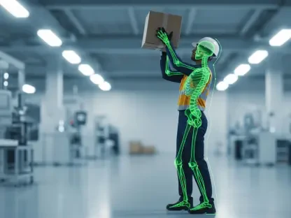
The utility of Xoople’s constellation extends far beyond theoretical modeling, providing immediate value through infrastructure monitoring. By utilizing high-resolution streams, governments can track large-scale construction projects and detect structural vulnerabilities in real-time, preventing costly failures. In the realm of agricultural intelligence, deep learning models applied to satellite data allow for the assessment of crop health, soil moisture, and yield forecasts with unprecedented accuracy, providing a vital tool for food security in a changing climate.
Disaster response and supply chain transparency also stand to benefit significantly from this high-frequency monitoring. Emergency services gain access to high-precision maps to track the progression of natural disasters and coordinate relief efforts more effectively than ever before. Simultaneously, logistics companies can monitor transportation networks and port activity to optimize global trade routes. As the cost of access to space continues to decline, the ability to turn that access into actionable intelligence became the primary driver for the next phase of global economic integration and environmental stewardship.