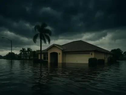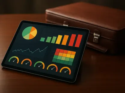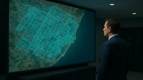

Automated systems now utilize the Normalized Difference Water Index (NDWI) to identify saturated soils and water-logged residential sectors during active flooding events. This shift from manual risk assessment to space-based intelligence represents a fundamental change in how global agencies manage catastrophes. Converting raw orbital observations into actionable risk scores requires a sophisticated synthesis of multiple data layers, including points, vectors, and rasters. Modern data scientists utilize GPS-referenced assets alongside pixel-based information such as digital elevation models and radar backscatter to create comprehensive hazard maps. This technical process enables a complex spatial join between environmental conditions and specific property locations, effectively filling the critical data gaps that have long plagued the underwriting sector. By layering these diverse datasets, insurers can transition toward a more precise, individualized understanding of hazard exposure for specific buildings.
Strategic Multi-Sensor Integration for Environmental Monitoring
Real-world applications, such as the analysis of the 2026 Coimbra floods, demonstrate the immense power of combining different sensor types to maintain visibility during severe weather events. While heavy cloud cover and high winds often render traditional optical satellites and drones useless, Synthetic Aperture Radar (SAR) provides a critical solution by penetrating storm systems. SAR utilizes microwave pulses to map flood extents regardless of light or atmospheric conditions, offering a reliable stream of data when ground access is completely denied. Once conditions begin to clear, high-resolution optical data is layered on top of the radar results to identify specific structural failures and localized damage. This multi-sensor integration creates a comprehensive damage footprint that serves as a definitive record for both emergency responders and insurance adjusters. By utilizing the strengths of both active and passive sensing, teams can maintain a continuous operational picture.
The ability to generate a reliable damage footprint without the need for physical presence in a hazardous area is a transformative capability for modern resilience planners. In the aftermath of the Coimbra event, the rapid deployment of SAR technology allowed for the immediate identification of breached levees and submerged infrastructure. This information was crucial for prioritizing rescue operations and deploying resources to the most affected sectors. Moreover, the persistence of satellite monitoring ensures that secondary hazards, such as landslides or building collapses, are identified in a timely manner. As these technologies become more accessible, the reliance on sporadic and often subjective ground reports is decreasing. The shift toward objective, sensor-derived intelligence provides a more stable foundation for long-term recovery planning. By integrating these diverse data streams, agencies can better understand the interplay between various environmental factors and their impact.
Optimizing Insurance Workflows and Financial Resilience
Integrating space-based analytics streamlines critical insurance workflows by enabling virtual inspections and significantly faster claims processing. Insurers now employ digital triage to prioritize severe losses, using satellite imagery to identify properties with total structural failure before a claim is even filed. This proactive stance is further enhanced by the rise of parametric insurance models, which utilize satellite-derived data as objective triggers for near-instant payouts. When a specific environmental threshold—such as a certain flood depth or wind speed—is detected via orbital sensors, funds can be released to policyholders without the need for a lengthy manual adjustment process. This speed is essential for businesses and homeowners who require immediate liquidity to begin the rebuilding process. Furthermore, the objective nature of satellite data reduces the likelihood of disputes over damage, as both parties have access to the same verifiable evidence.
Beyond immediate claims handling, the observed data points from satellite missions allow underwriters to calibrate catastrophe models with high precision. Traditional models often suffer from systematic biases because they rely on historical data that may no longer reflect the current environmental reality. By incorporating real-time satellite observations, analysts can correct these biases and improve the overall accuracy of risk pricing. This enhanced modeling is particularly beneficial for the reinsurance market, where large-scale risk transfer depends on a clear understanding of potential loss scenarios. Improved accuracy in catastrophe modeling leads to more stable premiums for consumers and a more resilient financial system overall. The ability to simulate various disaster scenarios using high-resolution topographic and environmental data allows for the development of more effective mitigation strategies. These tools are now core to the financial sector’s disaster resilience.
Advancing Global Stability Through Technological Adoption
Satellite technology served as a scalable, cost-effective solution that eliminated the reliance on delayed or unavailable ground reports during recent crises. By offering high-quality pre- and post-event comparisons, these tools reduced disputes between insurers and policyholders while increasing the safety of emergency responders on the front lines. The implementation of automated data pipelines ensured that critical information reached decision-makers within hours rather than days. Stakeholders who adopted these space-based insights were able to navigate the complexities of large-scale disasters with greater agility and confidence. The synergy between aerospace technology and disaster resilience strengthened the global financial sector’s ability to manage catastrophes, providing a clear blueprint for future risk management. It became evident that the transition to digital assessments was not merely a technological convenience but a fundamental requirement for maintaining economic stability.
Moving forward, the focus shifted toward the standardization of satellite data formats to ensure seamless integration across different platforms and agencies. Investing in the cross-calibration of SAR and optical sensors proved to be a vital step for maintaining operational continuity during varied weather conditions. It was recommended that insurers and government bodies collaborate on shared data repositories to maximize the utility of orbital intelligence. Furthermore, the development of more sophisticated machine learning algorithms for automated damage detection became a priority for those seeking to minimize human error in large-scale assessments. These actions solidified the role of satellite analytics as the primary engine for disaster risk reduction. By embracing these advancements, the global community established a more proactive stance against the unpredictability of natural hazards. The focus on objective data eventually led to more equitable recovery processes.